by Megan L. and Christof T.
The trail
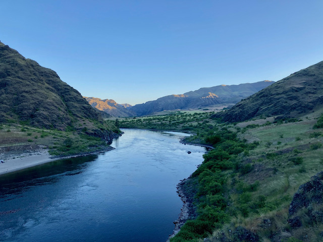
“The Snake River National Recreation Trail (#102) winds its way along the Idaho side of the Wild and Scenic Snake River deep in the Hells Canyon National Recreation Area” [Source]. The Snake River was named for the Snake tribe of the Shoshoni Indians. “The Snake River National Recreation Trail (#102) winds it way along the Idaho side of the Wild and Scenic Snake River deep in the Hells Canyon National Recreation Area. Beginning at the Snake River Trailhead near Pittsburg Landing, the trail goes across rocky slopes, under cliffs and along grassy canyons eventually ending at Brush Creek. This trail provides access to side trails that enter Hells Canyon Wilderness” [Source].
According to the trailhead sign (see photo below) and this USFS page, the trail officially starts at the Upper Pittsburg Landing trailhead (a.k.a. the Snake River Trailhead, 45.622389,-116.464175), and not as commonly assumed at the Lower Pittsburg Landing trailhead (0.4mi down the road from the Snake River Trailhead).
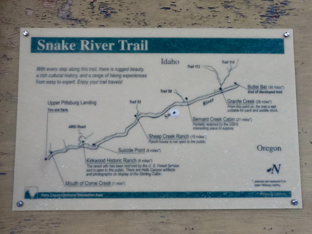
While the trail was originally built to Lamont Springs [Source], the trailhead sign indicates the end to be at Butler Bar (mile 30). However, recent reports many other online sources, and our own exploration (May 16, 2021) determined that the trail does not continue beyond Granite Creek (mile 28) and has probably been abandoned for decades. The Granite Creek bridge has also been washed out for many years. As the photos below show, Granite Creek can be raging and may be impassable. Granite Creek should be considered the current and official end of the trail. What’s beyond is not a trail and not maintained. The NRT database also confirms this: “connects Pittsburg Landing to Granite Creek.”
According to the trailhead sign (see photo above), the trail from the Upper Pittsburg Landing trailhead to Granite Creek is 28mi long. It can be done out & back from Pittsburg Landing, or one can book a jet boat ride (e.g., http://snakeriveradventures.com) and be dropped off at Granite Creek.
Expect rattle snakes and lots of poison ivy. No permits are required.

Yes, this is poison ivy and the trail goes right through it.

Not a rattlesnake.
The report
Team Hair-no-Hair (a.k.a. Megan & Christof) decided to meet up again for a quick weekend adventure. We were inspired by a recent report on OregonHikers.org by Brad, who had completed the Snake River National Recreation Trail (SRNRT) #102 in 3 days in April: https://www.oregonhikers.org/forum/viewtopic.php?f=8&t=29628
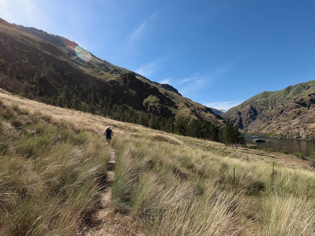
We started at 6:53am on Saturday, May 15, 2021, at the Upper Pittsburg Landing trailhead (a.k.a. the Snake River Trailhead, 45.622389,-116.464175). The day was predicted to be warm and sunny; it did not disappoint. We, however, were quickly disappointed by our lack of PPE (power, pep, and energy). Countless micturation and photo stops—plus the ever-thickening groves of poison ivy—didn’t help. The further we went, the more grass enveloped the trail, making route-finding a pain and rattler reconnaissance nearly impossible.
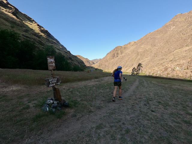
Kirkwood Ranch was buzzing with hikers who were tearing down their camps or already huffing and puffing up the steep return from the ranch. After several stop-and-chats, we were relieved to find more solitude past David Kirk’s grave. This relief was short-lived, squashed by the emergence of rattlesnakes and sock-snagging cactus.
At Sheep Creek Ranch we took a slight wrong turn, following a trail that went a little too far up the creek. Despite the detour, the rushing water provided a cool, pleasant relief on an increasingly scorching day.
After what felt like 50 miles, we reached McGaffee Cabin at Bernard Creek. Here the trail seemed to totally surrender to poison ivy, which bit cruelly at Christof’s knees and thighs. (He oozed for days.)
After 28ish miles we finally reached Granite Creek. It was raging treacherously. We spent more than 45 minutes traipsing up and down the slope, searching for a bridge or shallow spot or some feasible crossing—and a trail on the other side. Alas, no trace of a trail nor crossing materialized. Though Christof eventually made it most of the way over the creek via logs, he could find no trail continuation. This confirmed what Brad and other reports over the last years mentioned: the trail does not continue beyond Granite Creek.


With the terminus verified, we turned around. The sun was hitting the canyon hard, and Christof started rationing his remaining gels while Megan casually snacked on waffles and Hostess cherry pies.

It was cold.
As darkness fell, so did our pace. The trail was indistinct and rocky and moths swarmed our headlamped heads. Still we tromped on, amused by troupes of black, lazy worms and reflective spiders—yet constantly on the look out for rattlers, ivy, and curmudgeonly skunks.
After an exhausting 18:32:15, we finally arrived back at the trailhead—itchy, dehydrated, and ridiculously jubilant to have finished under 20 hours.

The photos


The stats
- Athletes: Megan L. and Christof T.
- Date: May 15, 2021
- Style: Unsupported
- Elapsed time: 18:32:15
- Distance: 2x28mi = 56mi
- Elevation gain: ~10,000ft
- Strava: https://www.strava.com/activities/5310193369 (GPS was on 1min interval)
- Relive: https://www.relive.cc/view/vrqo8pjR4Kv
- FKT route: https://fastestknowntime.com/route/snake-river-national-recreation-trail-srnrt-102-id