Summary
On Nov 29, 2021, I finished a self-supported Fastest Known Time (FKT) of the 300mi/483km long Monumental Loop (runner version) in southern New Mexico in 139:51:28 (5d 19h 51m 28s). Nobody had so far had made a self-supported attempt of this route. This was my longest and flattest turkey trot so far.

This was my 300mi extended turkey trot. Less turkey, more trot. In fact, no turkey at all. I didn’t even eat the turkey sticks I had packed.
The movie
Coming sometime this century, hopefully…
The route
Spearheaded by Matt Mason, with collaboration from Jack Kirby, Dan Carter, and other Las Cruces bikepackers, the original 350 mile Monumental Loop route was first published in 2017 as a “full tour” of the Organ Mountain-Desert Peaks National Monument. Watch an interview with the founders.
In March 2021, in an effort to increase rider accessibility, an updated bike loop, the Monumental Loop 2.0 (shown in yellow in the map below), was introduced. The new route is only 255 miles long, cuts out some sandy and rocky sections, but still visits all four units of the Organ Mountain-Desert Peaks National Monument and passes by seven wilderness areas. The original 355 mile route has been renamed “The DangerBird.” It remains an option for riders and runners. The FKT runner route (shown in red in the map below), as established and completed by Ella Raff, Garth Reader, and Peter Livingstone, is a 300 mile variant of the original 350 mile bike route.
The map below shows all three routes. I followed the 300 mile (red) runner route as Ella, Garth, and Peter did.

The three established Monumental Loop routes: RED = 300mi runner route; RED + PURPLE extras = 350mi original route; YELLOW + RED segments = 255mi 2.0 bike route.
The route simplified

The Monumental Loop simplified: a trail runner’s perspective. This is how it felt, not how it is. Mileage not accurate. Do not use as a map.
Prep and logistics
Spreadsheets say it all. Perhaps for the first time, my predictions were somehow accurate. I finished 6min past my predicted arrival time. The logistics were further complicated because of Thanksgiving-related reduced store hours and store closures.
For logistical reasons, I decided to complete the southern loop in counter-clockwise direction first. I would then return to the Mesilla Plaza and head out in clockwise direction to complete the northern loop. Both loops are approximately 150mi, so the Mesilla Plaza would be my half-way point. Ella, Garth, and Pete had all done the northern loop in counter-clockwise direction first.
Because the natural water resources as well as the cow troughs on the route are highly unreliable, I had made water drops in 10 strategy locations along the route. The longest stretch without reliable water access between my water drops was about 43mi long.

Spreadsheets are the answer. There’s no need for a question even.
Photo report
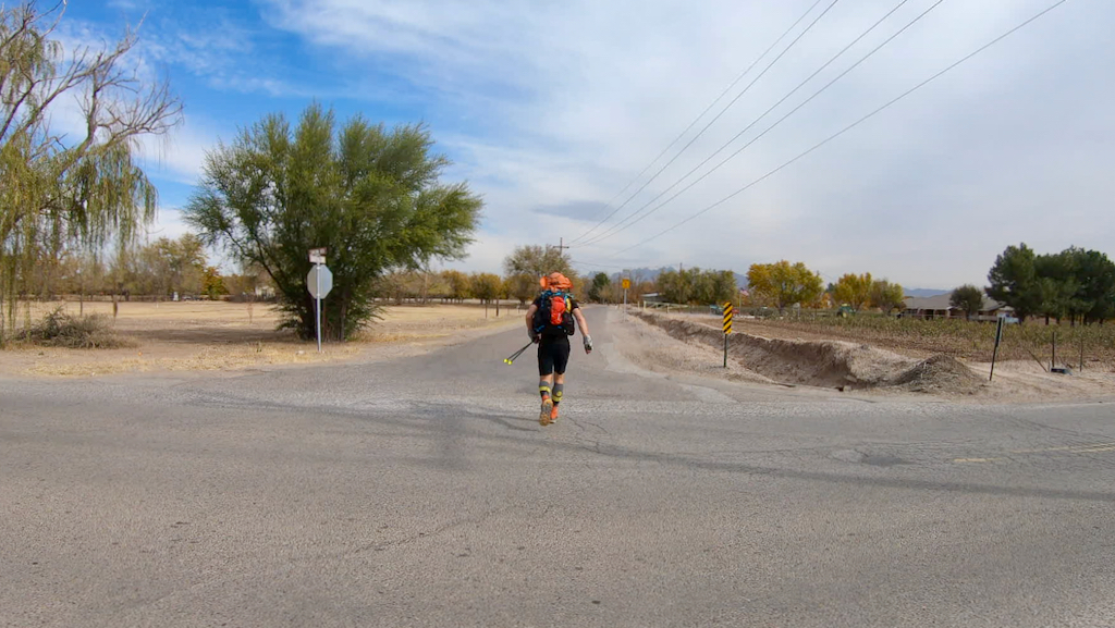
At 11am on Tue, Nov 23, 2021, I was on my way at the Mesilla Plaza. The first 30mi or so were going to be a terrible pavement and dirt road walk. I had mentally prepared for that. Or so I thought.

Let’s get this started. If all goes well, I’ll be back here in a few days.

11:15am, Nov 23, 2021. Go!

See you in a few days…
Soon it felt like I had left the city of Las Cruces. That was fine by me. I was ready for some solitude. Also, I needed to pee.

Crossing the Rio Grande. It was completely dry.

I tried to run some sections, but the pack was obviously heavy and running was hard.

The first mayo stinger went down well. A few days later I elevated the irresistible snack to the next level. Stay tuned…

Night started to fall, clouds moved in, and the wind picked up.

As a treat, I had carried a (non-alcoholic) bed beer. It was greatly appreciated.

After less than an hour of sleep it started to rain and I had to re-organize my bed and build a shelter. It was a short and unpleasant night. This is also the spot where I punctured my inflatable mattress. Amateur! From now on, I had to sleep on the ground in freezing temperatures.

The new day greeted me with a lot of soft ground. The moving was slow and required a lot of effort. Somewhere around here I also punctured my thigh with a rusty barb wire. Not until I finished did I actually think about tetanus. More on that later…

Yes, sand in all cracks. Also, notice the many thorns stuck in the sole.

I was surprised to see many of these in the middle of the desert. I had no clue whether it was some sort of pumpkin, gourd, or cucumber. I didn’t attempt to eat it, but was tempted. Well, it turns out it’s a Cucurbita foetidissima, also known as buffalo gourd, calabazilla, chilicote, coyote gourd, fetid gourd, fetid wild pumpkin, Missouri gourd, prairie gourd, stinking gourd, wild gourd, and wild pumpkin. And they are edible.

Ella, Garth, Pete, and myself have clearly demonstrated that one CAN walk to safety from here. It is, however, a long walk.

After another endless day and night on endless roads, in bitter cold rain and wind, I finally reached Westway in Texas. It was Thanksgiving Day and my only resupply option was a 24h gas station. They were very kind and let me sit at their tables and organize my stuff out of the wind and rain at 3am in the morning. I did what I needed to do quickly and was on my way again.

The weather had definitely turned sour and it was raining on and off. The wind was so bad that I had trouble walking upright in some spots. And there was no shelter anywhere to escape the weather. Even in the deepest and most narrow canyons the wind was howling. At least inReach weather forecast said it would improve. It eventually did, but it took pretty much all day.

Another day ends. I wouldn’t say in a good way. At least the weather had improved and the horrible wind had died down.

As I reached the outskirts of Las Cruces, it was late, everything was wet, and I was sure I was not going to be able to traverse the city before I needed a sleeping spot. I told myself that if I wouldn’t find a hotel on the way across the city, I would quit. Finally, after crossing the beautiful and completely deserted campus of New Mexico’s State University, I spotted a Ramada Inn. It felt slightly wrong, but I couldn’t say no, and I’m glad I didn’t. In true tru-hiker fashion (and in accordance with self-supported FKT rules), I decided to get a room for a few hours of sleep and to dry my gear. But alas, it took the front desk team almost 30min to check me in because of some weird computer problem. After the 3rd computer reboot, I got slightly impatient.

Before 3am I was on my way again and reached the Mesilla Plaza at 3:30am. 64h15min to reach the halfway point (150mi). I felt strangely revitalized and pressed on through the deserted city and along the dried-up Rio Grande.

Before slogging around Pichaco mountain, I resupplied at a 24h Pic-Quik gas station store at Fairacres on I-70, which had a 24h Santa Fe Grill that sold huge burritos. I got two for the road, plus lots of cheese sticks and other calories-rich goodies.

Footcare: I started to have some serious ankle and shin issues. Cutting open the socks to remove some pressure did not work anymore. In addition, I had developed a blister under the big toe. I tried to burn a hole through the nail with a hot needle, but was unsuccessful.

More flat, more sand, more roads, more desert. More of the same.

Yet another night were I thought it would be dry (according to the forecast), and then it started raining less than an hour after I fell asleep. By then I was used to getting up and to setting up shelter. Why not set up a shelter from the beginning, you are asking? Because that is also a pain.

The Monumental Stinger Mayo Mozzarella Taco. A little known local treat.

Did I say rocks? Yes, lots of f*&ing rocks. For miles and miles and miles. The northern loop is definitely a lot more rocky and rugged.

It was not windy (except in my butt) on Windy Gap.

Fresh socks before the road walk. And that white cream is HikeGoo. It works for me.

Here is where the most horrible highway walk I’ve ever done started. It was about 9mi to Hatch. This section almost broke me and had there been a good spot to wait for a ride, I may have quit. But there was no good spot, which tells you something about that section.

I reached Hatch mentally and physically completely drained and sat at the store’s entrance for a while. The Christmas carols they were playing outside were beyond terrible and I got irritated. I finally got my act together, pulled out my shopping list, and did what I needed to do. The only thing I was craving was something to drink and an ice cream. I threw up both a mile outside of Hatch. That was that.

On I went into yet another dark night, along endless pecan tree farms, cotton and chili fields, and barking dogs.

After sleeping under a pecan tree (trespassing, I’m sure) and many more hours of wandering through random hills with rocks and cacti, I heard and saw I-10. To reach the I-10 rest stop, which is an “official” Monumental Loop water stop, I had to climb two fences. Because the night was bitter cold, I spent a long time warming up with the rest area’s hand dryer. Thankfully nobody else wanted to use it at 2am. I turned it on again.

A few miles after the rest area, and after spotting several trail cameras, one of the many border patrol trucks that had passed me suddenly stopped and the agent asked whether I had climbed a fence at the rest area. I said yes, and that I got water there. I left out the hand dryer details. I glanced into his truck and saw a screen that showed a thermal image of the surroundings. Fancy! They must have sensors and cameras everywhere. Later, I heard a drone flying above me. There really is no hiding.

Finally more mountains again. Not the good type.

The pure joy of running 300mi. This I faked.

I made it to the MacDonalds at the I-70 crossing with about an hour of reserve before it closed. Ughs. That was my last and crucial resupply point. Had I missed it, I would have had to quit. I ordered 4 cheeseburgers at the drive-thru and a milkshake. I really didn’t want to sleep again, but a mile or so past the MacDonalds, I had to lay down for an hour in a dirt lot under a power line. It was highly romantic. Also brutally cold without an inflatable mattress.

After MANY more endless and frustrating hours on motorcycle trails, dirty roads, and other nondescript roads, I finally reached Las Cruces. Again. At some point I passed a large reservoir where all the historic figures seemed to wear masks. Clearly, they were ahead of times.

The slog through the city toward the finish line seemed endless and I was in great discomfort.

Completing the Monumental Loop was not listed here. Was this a sign I had the wrong priorities in life? Anyway, it was too late to undo that.

After 139h and 51min, I was finally done. It was about time. I had to pee and was getting hungry because I was out of food. Should have ordered a few more cheeseburgers…

Pete (the current male supported FKT holder) and wifey were both at the finish line. I was initially hoping I wouldn’t have to witness another sunrise before the finish, but I was forced to. It was fine. We chatted for a while and before I froze to death, Ursina drove me to our hotel were I showered and passed out for several hours. I did not pee in the porta potties, but I should have. Photo credit: Pete Livingstone.

I had dreamed to grab lunch at Spotted Dog Brewing, which wasn’t open when I had passed it in the middle of the night. So we did. It was delicious.

Later, we grabbed some quick dinner at Bosque Brewing. I do not remember much. The next morning we had to drive back to Albuquerque and fly back to Portland.
Once we got home, I checked my vaccination records. It was 19 years since I’ve had my last tetanus shot. One is supposed to get a booster shot every 10 years. Ughs! Plus, if you get exposed, you have to get one within 48h, not within 6 days. I managed to schedule one for the next day, together with my COVID booster shot, but it would not help to prevent an actual tetanus infection, had I been exposed at the beginning of my trip. Well, that wasn’t smart of me. Perhaps I should keep up with my shots the next time.
Thankfully, so far I had no signs of infection or any tetanus symptoms, but it can take up to 21 days for them to appear. Fingers crossed…
Lessons learned
- The northern loop is lot harder, slower, and rockier. I think it would be better to do the northern part first.
- If you do not like a lot of paved and dirt road walking, don’t do this route.
- Some water tanks require some sort of scoop or bottle tied to a rope to get to the water. Bring a 10ft rope or so that allows you to lower bottles into tanks.
- Do not rely on natural and artificial water sources unless you checked them the day (or so) before.
- Expect terrible mud if it rains.
- Some cow ponds and/or troughs are very muddy and require extensive filtering.
- There is lots of soft sand, especially on the southern part. I wore gaiters and was happy to have them.
- I saw zero snakes, centipedes, spiders, mormon crickets, scorpions, or other potentially dangerous/annoying critters in late November. The only critters I saw on the ground were Pinacate Beetles, aka “stinkbug.”
- I saw numerous skunks. It’s best to stay far away from them.
- Approximately every house you will pass will have a bunch of barking dogs in the yard.
- Expect no cars to stop and ask whether you are fine or are in need of something.
- Expect lots of border patrol on some stretches, especially around the I-10 rest area, where they have a highway checkpoint. Tens of trucks passed me on that road. Some stopped, but most didn’t. I presume they are afraid that some folks may attempt to bypass the highway checkpoint on foot.
- Even in the late fall or winter, the days may be sizzling hot, but desert nights can be brutally cold. Expect your water bottles to freeze.
The stats and data
- Style: self-supported & solo
- Start date: Nov 23, 2021
- Finish date: Nov 29, 2021
- Start location: Mesilla Plaza
- Finish location: Plaza de Las Cruces
- Elapsed time: 139:51:28 (5d 19h 51m 28s)
- Distance: 300mi/483km
- Elevation gain: 18,517ft
- Strava: https://www.strava.com/activities/6324017444
- SPOT: https://maps.findmespot.com/s/79B0
- Relive: https://www.relive.cc/view/vYvr4xZpGx6
- FKT entry: https://fastestknowntime.com/fkt/christof-teuscher-monumental-loop-nm-2021-11-29
Acknowledgments
A big thanks to Ella and Pete for sharing trail intel, to Garth and Ella for their most useful reports, and to Pete for coming out to the finish line!
Resources
- Monumental Loop FKTs: https://fastestknowntime.com/route/monumental-loop-nm
- Monumental Loop page: http://monumentalloop.com
- Monumental Loop on Bikepacking.com: https://bikepacking.com/routes/monumental-loop
- Monumental Effort: https://www.newmexicomagazine.org/blog/post/biking-organ-mountains-monumental-loop
- Monumental Loop on Instagram: https://www.instagram.com/monumental_loop
- Monumental Loop on Facebook: https://www.facebook.com/monumentalloop
- Ella’s reports:
- 2018: https://ellaraff.wordpress.com/monumental-loop-2018
- 2021: https://ellaraff.wordpress.com/2021/11/03/monumental-loop-2021-my-word-means-nothing (and sub-sequent posts)
- Garth’s report: https://ultrastageracing.com/after-action-reportsrace-reports/monumental-loop