[read_meter]
Executive Summary
It took me 104:42:13 (4d 8h 42min 13s) to summit all 33 peaks over 9,000ft (2’743m) with at least 300ft (91m) of prominence in Oregon’s Eagle Cap Wilderness in a single push. This was my 4th attempt. I’m glad this 3-year project can now be labeled as completed.
104h 42min were needed to bag all 33 peaks over 9,000ft with at least 300ft of prominence in Oregon’s Eagle Cap Wilderness.
The Challenge
The Eagle’s 33 Challenge consists of summiting all 33 peaks over 9,000ft (2743m) with at least 300ft (91m) of prominence in Oregon’s Eagle Cap Wilderness (aka Wallowa Mountains) in a single push. The maps (both static and interactive) below show the 33 peaks. For more info (e.g., GPS coordinates, rules, etc.), please hop over to the challenge page.

Bird’s-eye perspective of the area with the 33 peaks over 9,000ft. For a complete list of the peaks, see Eagle’s 33 Challenge.
Movie
In the works, stay tuned and come back! If you can’t wait, you could (re-)watch the 2nd attempt movie.
Attempts
It took me three years, four attempts, a lot of discomfort, and a seemingly endless obsession to properly wrap up this challenge. The table below shows all four attempts. I hope I can now come to rest.
| Attempt | Date | Number of peaks | Elapsed time | Report | Movie |
| 1st | Sep 1, 2018 | 14 | 51:42:39 | Here | Here |
| 2nd | Aug 8, 2019 | 31 | 85:46:15 | Here | Here |
| 3rd | Aug 8, 2020 | 32 | 110:16:45 | Coming soon | Coming soon |
| 4th | Sep 2, 2020 | 33 | 104:42:13 | This page | Coming soon |

Visualization of how many hours it took me to bag one peak on average. The time includes all sleep time. The blue line is the trend line. I got faster over time. The 2nd attempt is an outlier. I’m not sure why. The weather was a lot cooler, perhaps that helped.
As you can see, each attempt led to more peaks being bagged and to route improvements. The 4th time wasn’t a charm, but I was able to shave off about 6h from my 3rd attempt by going clockwise on my loop and by devising out better lines. And yes, this time I was able summit Needle Point (which I failed to completely summit at the very end of my 3rd attempt). I even scrambled up the Twin Peaks tower, which was not as hairy as I expected.
One of the worst moments was to realize during my 4th attempt that I could actually have scrambled over to the Needle Point summit from the ridge I was stuck on. I only discovered the line because I went clockwise and came up the Northwest ridge this time. Scrambling over to the East ridge required me to drop down a bit from the summit and to climb through some exposed rock, but it was feasible. Although, admittedly, it would have been possible to fall to death (by far not the only place where that is possible, however). So basically I could have completed the route perfectly in my 3rd attempt in an additional 20min or so, had I known about this line. Oh well…

Stuck in the wrong ridge less than 300ft horizontal feet from the actual Needle Point summit on my 3rd attempt. This was the very last peak on my then route.
The routes I took are solely my creation. I had an initial (naive) idea in 2018, but it has evolved over the years as a function of many recon trips and of my attempts. Anybody who wants to attempt this challenge is free to design their own route. And of course you are welcome to follow mine, but please read the disclaimer at the bottom of this page carefully before you venture out. I do not recommend my route to anybody because I neither consider it sane nor safe. There are many ways to get in serious trouble or to die.
[pullquote]It’s a superb challenge in so many ways and I hope others will tackle it.[/pullquote]
The more familiar I became with the terrain and the route over the years, the more I was able to bag peaks at night. During my first attempt, I was basically unable to move at night because I needed to make up my line on the go. During my 4th attempt, I bagged 13 peaks (including Glacier Peak and other non-trivial peaks) in the dark, as you can see from the summit pics below.

The “timeline sketch” I carried. The rest of the plan was in my head and on my GPS.
After each attempt I was absolutely certain that I would never ever go back because it was such a taxing, dangerous, and challenging adventure. It usually didn’t take long until I forgot about the bad aspects and was scheming yet another attempt. After all, the Wallowas are spectacular, even for Swiss standards ;-). And I realized that no matter what, this project had to be completed.
That’s it for now. A lot more stories to be told in the upcoming movie…
Wear and Tear
The route is extremely rough, not just on your soul and mind. Each attempt led to a lot of wear and tear on my gear. La Sportiva Mutant shoes typically last me 400 or more miles, but one pair was barely enough for one Eagle’s 33 attempt. Thanks granite! Ditto for the Leki poles I used. The metal tip broke off, the strap loops tore under the constant load, and the cork came off almost entirely. But thankfully none of the poles ever broke. Thanks Leki!

Worn-out La Sportiva Mutant soles. Thanks granite! The shoes were new at the start. Each attempt required a new pair of shoes.

Torn-up Leki poles.
Summit Pictures
“There are only 10 types of people in the world: those who understand binary, and those who don’t.”


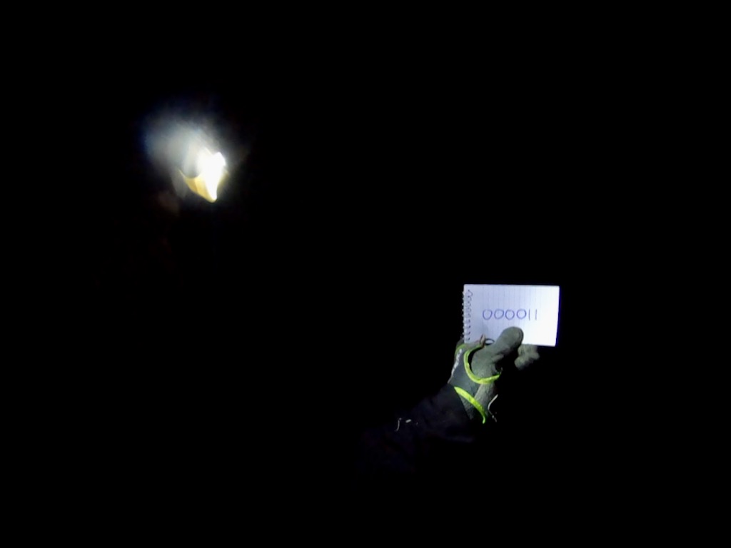
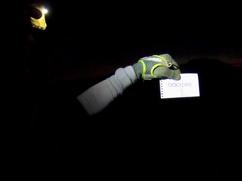


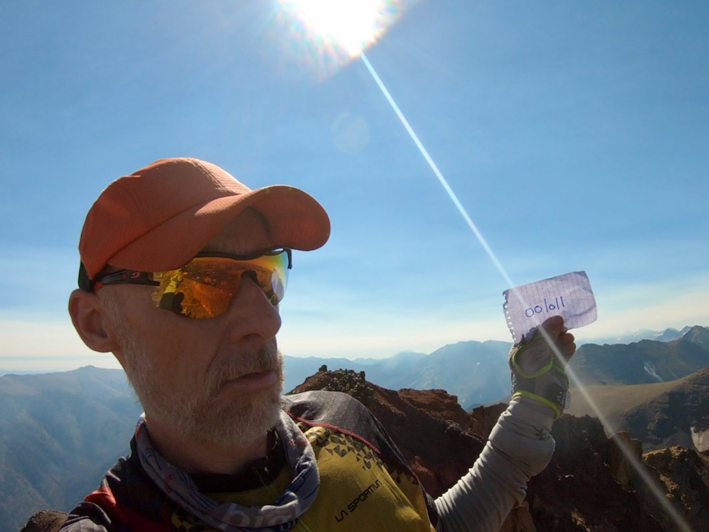


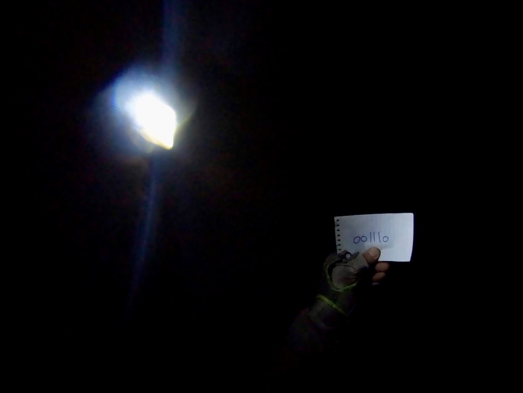
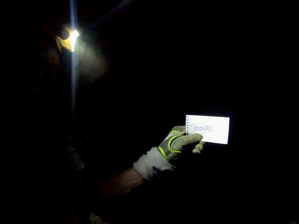
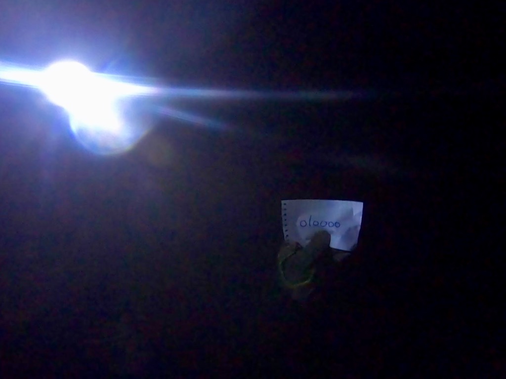


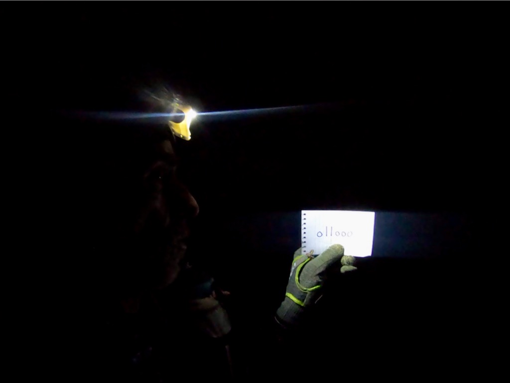
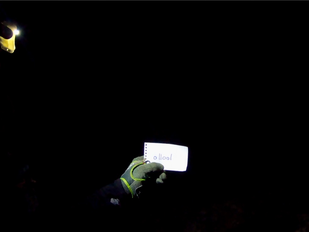
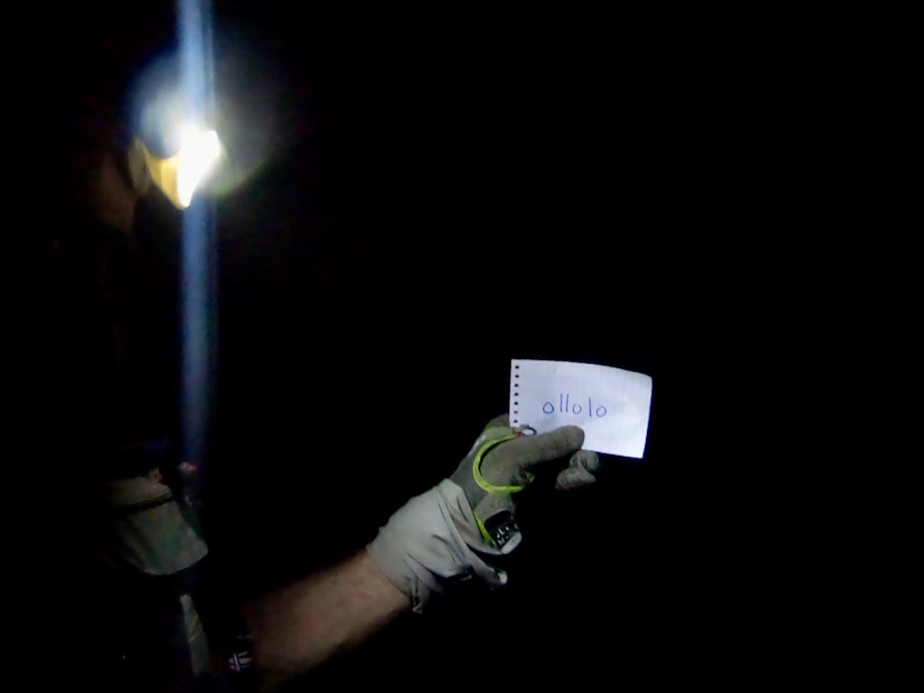
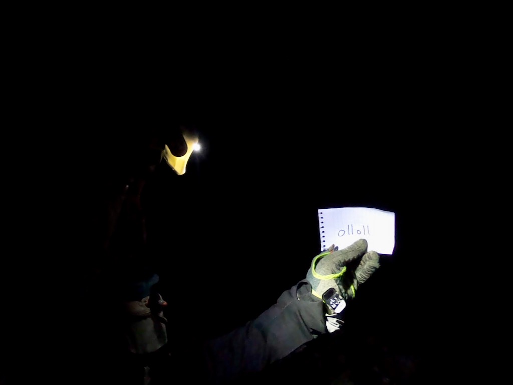
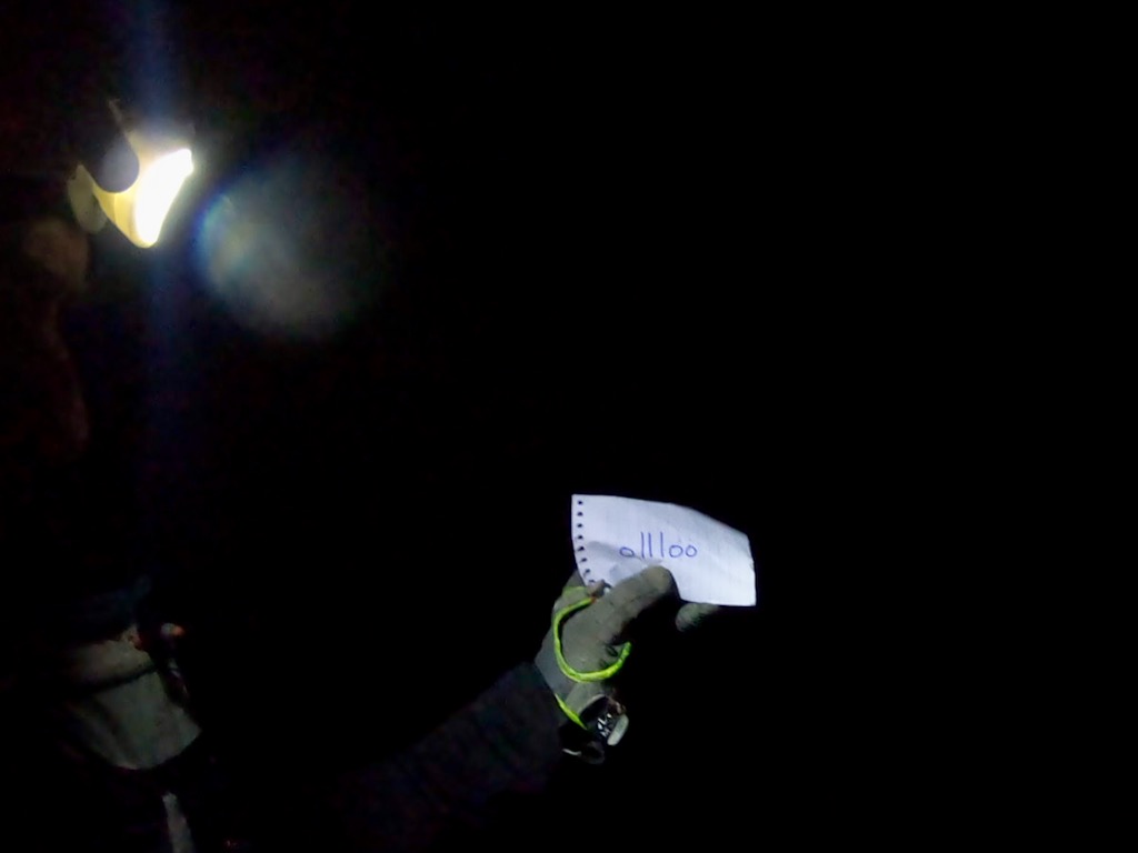
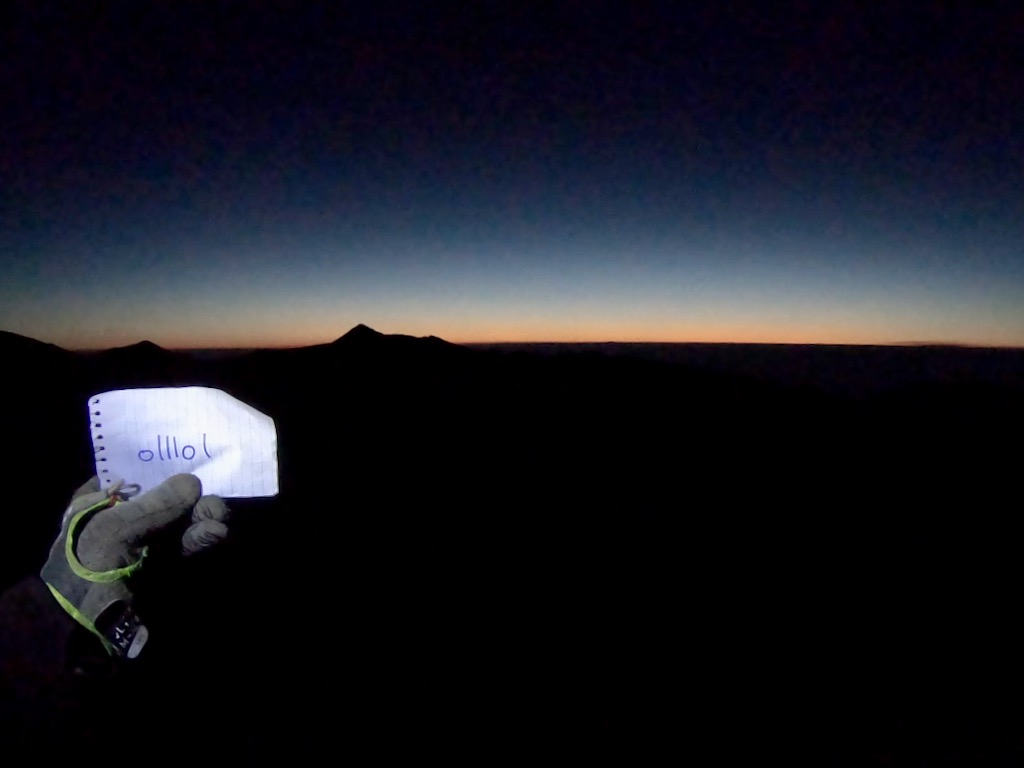


Noticed anything unusual? There is no #10 peak. I must have ripped off two sheets at the same time for peak #9 without noticing. So when I realized that there was a sheet missing toward the end of the route, I used the same number for peaks #30 and #31.
Data
- Start date: Wed, Sep 2, 2020
- Finish date: Sun, Sep 6, 2020
- Start/finish location: East Eagle Trailhead
- Elapsed time: 104:42:13 = 4d 8h 42min 13s (Strava)
- Style: self-supported (I had one food cache at Hurricane Creek).
- Route length: 98.24mi (Strava) [probably more like 110mi]
- Elevation gain: 57,642 ft (Strava)
- GPS data:
- GPS intervals:
- Suunto Ambit 3: 1min, so it is not very accurate and short-logs.
- SPOT: 10min

Route elevation profile. There are no flat sections, I am afraid.
GaiaGPS
SPOT Tracking
For fullscreen, go to http://bit.ly/Eagles33IV.