By Megan L. and Christof T.
[toc]
[read_meter]
Executive summary
Megan L. and Christof T. set a first unsupported Fastest Known Time (FKT) in 31:49:40 on the 88mi out-and-back Kettle Crest Trail.

Kettle Crest National Recreation Trail, the granddaddy of long-distance, high-country routes in Eastern Washington. It’s so good we did it out-and-back.
The trail
“The Kettle Crest Trail is the granddaddy of long-distance, high-country routes in Eastern Washington. Over the course of its 44 miles, it presents a virtual highlight reel of dry-side beauty, from sage-scented meadows to subalpine parkland
The Kettle Crest Trail is part of the 1200 mile Pacific Northwest National Scenic Trail, which extends from Glacier National Park in the east, to Olympic National Park in the west.
Located in the far northeast corner of the state, the Kettle Crest features a half-dozen of Eastern Washington’s highest peaks, some topping out at more than 7,000 feet. Nominally a ridge-running route, the Kettle Crest tallies up nearly 8,000 feet of cumulative elevation gain over its length. Yet there are no cloud-piercing spires here, just a mosaic of old-growth forests and open sagebrush meadows, from which shimmer distant vistas of the Cascade and Rocky Mountains.
Owing to its diversity of habitats and lack of human development, the Kettle Range boasts some of the best remaining wildlife habitat in Eastern Washington. Hikers should keep their eyes peeled for cougar, moose, mule deer and black bear, all cruising the high country. But in summer, the dazzling array of wildflowers—buckwheat, lupine, aster, yarrow, paintbrush, hawkweed and others—will likely keep your attention focused on the foreground.
From the southern trailhead, ascend through profuse wildflowers on White Mountain before beginning a view-packed stretch past Barnaby Buttes and Bald Mountain. The southwest slope of Snow Peak holds great camp spots near the shelter. Skirt Sherman Peak and Columbia Mountain, then traipse along a sagebrush lined ridge; camp sites are scattered along the way. The high point is 7,140-foot Copper Butte, where fragments of an old lookout remain.
Descend through a ghost forest of snags and settle in for open grasslands and lupine-filled fir forest, all the way to the northern trailhead at Boulder Pass. This is one of the sections of the trail that creep under ghostly silver snags left standing from past wildfires, most notably the 1988 White Mountain Fire, which scorched more than 20,000 acres of the southern Kettles. In these sections, wildlife, wildflowers and wide-open views have taken the place of the trees, making this one of the scenic highlights of the region.
Aside from a few wooded saddles, virtually the entire route offers up big views: to the south, the Colville Indian Reservation and northernmost reaches of the Columbia Plateau; to the west, the Okanogan Highlands and, beyond, the Cascades; to the north, the peaks of British Columbia; and to the east, Idaho’s Selkirks.
To the Colville tribe, whose ancestral lands encompassed the Kettle Range, the mountains bear sacred significance. On White Mountain, near the southern terminus of the trail, hikers can inspect cairns built by young members of the tribe during vision quests. Subsequent generations of visitors have also fallen under the spell of the Kettles, and a dedicated group of local conservationists has spent the last 40 years pressing for a congressional designation of wilderness for the Kettle Crest.”
Source: https://www.wta.org/go-hiking/hikes/kettle-crest-trail
This is how we rolled
After a bright, brown, and (seemingly) endless drive, we quick-pitched a tent at Deer Creek Forest Camp, handily located just across the road from the Kettle Crest North TH. The 2015 Stickpin fire had destroyed all traces of forest, but the camp had been recently refurbished with gravel, picnic tables, and a satisfactory pit toilet. There were no bugs and a pleasant, smoky glow on the horizon when we turned in. Our plan was to start at at 4 a.m.

A moment of packing chaos…

Megan is trying hard to love her Salomon pack. The love was not returned.

Finally ready!

Still smiling.

Flowers everywhere!

Do you happen to have more toilet paper?

No ticks and mosquitoes so far.
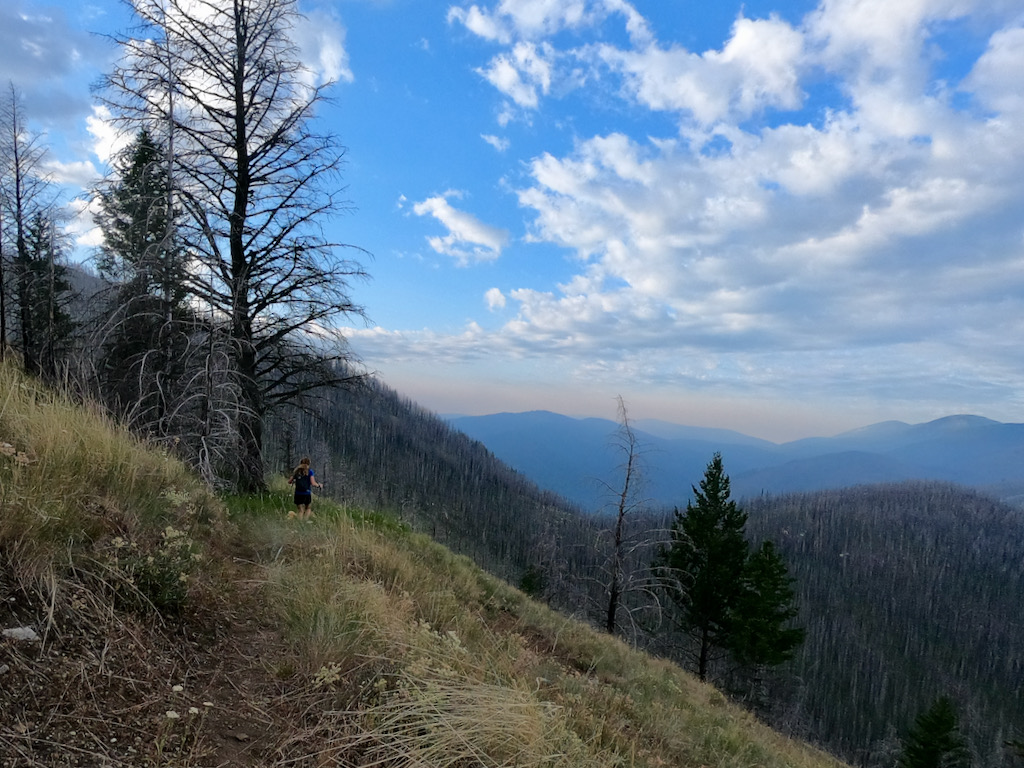
Grassy slopes, gorgeous views.

The trail exists.
We hit the first edge of the crest around mile 10 and the first spring at mile 15. There was residue on the dribbling PVC pipe and an algae crust on the trough. Still, Christof insisted the water was pure and potable. He did not filter and anxiously awaits cryptosporidium episode 2.0. Whilst Megan (prudently) filtered, he noticed that both his rain jacket and long-sleeve—previously stuffed under the outer elastic cords on his new Montane pack—were missing. What?! After deliberating, we decided it wasn’t worth going back (possibly for miles) to find the lost items. The night was predicted to be warm, and Megan had both a long-sleeve and a rain jacket; we could each use one.

Our first watering hole.
Onward we trundled. The trail fully lived up to its name, following the crest and offering sweeping and spectacular (albeit smoky) views of Ferry County. We stopped briefly to sign the summit register at Copper Butte, the route’s high point (cleverly, there was a joint stashed with the register in a tin can). The views continued to amaze us as did the outstanding trail maintenance. For such a remote route, the tread was remarkably clean, and we only remember crossing two downed trees on the entire trip.

There was an opportunity to get even higher on Copper Butte.

Is this smoke? Yes it is.
The least scenic section was the State Highway 20 crossing, fortunately the only road crossing on this trail. Here dust billowed around wilting weeds and clung to our damp socks, and a few pointless and steep switchbacks temporarily turned us off. However, as we circled Sherman Peak, crossing a helpful stream and leaving the highway noise behind, our moods improved. After Sherman we climbed around Snow Peak, finally closing in on White Mountain and the southern TH. Somewhere in this section we spotted a massive smoke plume, appearing to be just a single ridge away from our destination. We watched the plume grow and spread for hours. It did not creep close enough to end our adventure, but we were worried for miles.
After skirting Snow Peak, we trudged over the infuriating Barnaby Buttes, kicking fresh bear scat with irritated and reckless abandon. The final ascent, both breathtaking and maddening, climbed White Mountain. It traversed a rocky slope, passed a murky spring, then plunged intensely to the southern trailhead. As we descended (hungrily, gingerly, suspiciously) we had trouble accepting the impending return. Fortunately the trailhead appeared sooner than expected. After 14h25min, we photographed ourselves with cautious joy. Next, we sat for a moment to reset and refuel—Christof with soon-to-be-regurgitated plastic baggy meals, Megan with waffles and cherry pies.

Extracting water, feeling the vibe.

Still going strong.

The last few miles lasted long.

Turnaround point at mile 44 (White Mt. Trailhead).

Well, not exactly fast. We blamed the heavy packs.

More fires, not too far away.

The last warm rays of sunshine.

That is the moon.
For an eternity we struggled to stay upright. Around 2 a.m., we decided a trail nap was necessary. We rolled up in an emergency blanket and passed out immediately. After close to 10 minutes Megan jolted up thinking she heard a bear. Though it turned out to be only Christof’s stomach, the nap wasn’t salvageable. As we continued, Megan—having shared her jacket with Christof—began feeling dangerously cold, so she used the emergency blanket as a shell and we both moved furiously. The wind continued to howl and temperatures dropped even more as sunrise neared. Neither of us was warm enough.

Thermal insulation or medieval costume?
We met the first PNT through-hiker just after sunrise. Maddeningly, he was bundled up in a down jacket and various other cozy layers. We asked whether he’d seen any lost clothing on the trail; aha, he had! With some optimism, we hurried on. We hurried for miles, searching the brush and finding nothing. By the time we discovered Christof’s long-sleeve, the sun was high and hot. We never recovered the rain jacket.
Soon after passing the final spring, we were marinating in sweat and dust again. We met a second PNT through-hiker, who looked fresh and like he’d just bought everything new at an REI just around the corner.
While Christof was hoping for an 9 a.m. finish, Megan predicted 11. We were both wrong. The last 8 miles were interminable, dusty, brushy, hot, dry, and, relentless. The dream flowerscape of our first morning had retreated. Eventually, after some grumbling, teeth-grinding, and silence, the trail spit us out at the trailhead. We were done in 31:49:40. It was just after noon.

That took forever. Never again.

Not just tired.

Cheers!
The details
- Athletes: Christof T. and Megan L.
- Style: Unsupported
- Trail distance: 88mi (out-and-back)
- Trail elevation gain: ~16,000ft (out-and-back)
- Start date: Jul 21, 2021
- End date: Jul 22, 2021
- Elapsed time: 31:49:40
- Strava: https://www.strava.com/activities/5676323881/overview
- SPOT tracking: https://maps.findmespot.com/s/N2S7
- Relive: https://www.relive.cc/view/vZqNYX1BmG6
- FKT page: https://fastestknowntime.com/route/kettle-crest-trail-wa